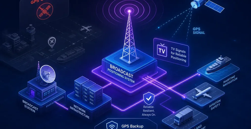
GPS is the invisible backbone of critical infrastructure timing in the United States, Canada, and many other Western countries, and it is more fragile than most engineers want to admit. Jamming devices are cheap and legal to buy in many jurisdictions. Spoofing attacks are increasingly documented against aviation and maritime systems. A severe solar storm can degrade satellite signals across entire continents with no warning whatsoever. For power utilities, 5G networks, financial systems, and broadcast operations, a GPS outage is not a theoretical risk; it is an engineering problem with no tested backup for most organizations. The Broadcast Positioning System (BPS) addresses that gap directly, turning NextGen TV transmitters into synchronized terrestrial beacons that deliver precise timing and physical location completely independent of satellites, internet, or cellular infrastructure.
Avateq Corp. has been developing solutions for all stages of this emerging technology, with units already deployed in NIST field testing and other trial sites across North America. The ecosystem is moving faster than most engineers realize, and organizations that wait for federal guidance before starting an evaluation will find themselves behind the infrastructure curve.
What The Broadcast Positioning System (BPS) Actually Does
TV Transmitters as Timing Beacons
The core concept is straightforward. ATSC 3.0 transmitters can be synchronized to a traceable time reference, and the system encodes a precise emission timestamp directly into the broadcast signal's bootstrap preamble. A receiver that reads that timestamp, knows the transmitter's location, and measures when the signal arrived can calculate the propagation delay and derive an accurate local time reference. No satellite is required. The entire calculation runs on signals from the broadcast tower sitting on a hill a few miles away.
The timestamp is carried in ATSC 3.0 L1D signaling fields - specifically L1D_time_sec, L1D_time_msec, L1D_time_usec, and L1D_time_nsec. A separate data PLP carries the transmitter's identity and geographic coordinates. The BPS data payload adds less than 10 kbps to the channel, which means it overlays cleanly on any existing ATSC 3.0 service without touching video or audio capacity.
From One Tower to Three: Timing vs. Positioning
A single BPS-enabled tower delivers time synchronization. The receiver computes its pseudorange to that tower, applies the known delay, and corrects its local clock. That is the timing use case, and it works with one good signal in view.
A second tower is worth more than incremental accuracy. With two stations in view, a receiver can cross-check the timing solutions against each other. This adds redundancy and gives the system a built-in spoof-detection mechanism: if one signal's derived time suddenly diverges from the other, something is wrong with the signal, not the clock. Diversity across RF channels helps too; stations spread over several frequency bands are harder to jam or spoof simultaneously than stations clustered on one channel.
Positioning requires more geometry. With three or more geographically separated towers, the receiver solves a multilateration problem using the pseudoranges from each site to estimate its physical location - the same math GPS receivers use, applied to terrestrial RF instead of L-band satellite signals. A four-tower configuration is most commonly described for reliable simultaneous time and position estimation. Three provides minimum geometry for position; four adds the redundancy needed for consistent results. That distinction matters when evaluating coverage in your specific market.
Why This Matters Beyond Broadcasting
BPS is not a broadcast industry curiosity. Power grid synchronization, 5G base station timing, financial transaction timestamping, and emergency services dispatch all depend on precise time references derived from GPS.
The numbers put BPS's headroom in perspective. Published requirements put mobile wireless network timing at about 1.1 µs, equity trading systems at 1 µs, and power grids at 1 µs with UTC traceability, and roughly 200 ns is considered sufficient across all critical-infrastructure sectors. A system field-measured at single-digit nanoseconds is not scraping by against those thresholds - it clears them by two to three orders of magnitude.
A power utility losing GNSS synchronization, for example, risks protective relay miscoordination across interconnected grid segments. A 5G network losing its timing reference degrades handoff performance across cell boundaries. Any of those sectors can benefit from a terrestrial PNT backup that keeps running when GNSS is degraded or deliberately attacked. The technology's value proposition extends well past the NOC.
How The Broadcast Positioning System Uses ATSC 3.0 Signals to Carry Timing and Location Data
The Signal Components and Receiver Processing Chain
BPS receiver processing follows a clean sequence:
- The unit measures time of arrival for the ATSC 3.0 bootstrap.
- It compares that to the encoded transmit time in the L1D fields.
- It computes the pseudorange to that tower.
- It repeat that process for additional towers.
- It uses the combined geometry to solve for position or correct the local clock.
Any engineer familiar with GNSS pseudorange processing will recognize the approach; the physics are identical, terrestrial rather than orbital.
The transmitter side requires three functional additions to a standard ATSC 3.0 chain: accurate reference timing input, measurement of the actual bootstrap emission time, and closed-loop adjustment of the exciter's preamble timing so the transmitted L1D timestamp matches what actually went out the antenna. The ATSC 3.0 standard itself needs no modification. This time-transfer over broadcast is an operational overlay, not a standards revision, and ordinary TV receivers ignore the BPS data completely.
What the Accuracy Numbers Actually Show
NIST Field Test Results for Timing
The NIST 2024 CRADA field study used two Avateq AVQ1050 BPS receivers deployed simultaneously at NIST's Boulder and Fort Collins sites, both receiving a live BPS broadcast from KWGN-TV in Denver. Each receiver's pulse-per-second output was compared against the local atomic timescale using time interval counters referenced to UTC(NIST), with single-shot instability around 50 ps. The test ran continuously for 22 days starting September 3, 2024.
The results: Time deviation (TDEV) below 2 nanoseconds across the full stationary test, with TDEV remaining below 2 ns over all averaging intervals. A separate 50-day non-line-of-sight field trial showed tens of nanoseconds peak-to-peak, still with TDEV under 2 ns. For comparison, GPS L1-only timing held below 4 ns TDEV over the same evaluation period. BPS nanosecond timing performance was not far behind the satellite reference and, in several metrics, matched it directly.
Positioning Performance and Where It Stands
Positioning is less mature than timing, and engineers should enter any evaluation with accurate expectations. The NIST CRADA study demonstrated distance-to-transmitter errors within 10 meters when signals from at least three towers were available. Real-world multi-tower positioning accuracy runs around 100 meters on average, depending on tower geometry, propagation conditions, and how many sites are in view. That accuracy level suits emergency fallback and coarse location applications, but it is not a GPS replacement for meter-level navigation.
Tower geometry drives a significant portion of the variation, the formal metric is Geometric Dilution of Precision (GDOP), the same figure of merit used in GNSS. Clustered towers, or towers that all sit in roughly the same plane relative to the receiver, produce poor GDOP and degrade the position solution regardless of how good each individual pseudorange is. Markets with well-separated ATSC 3.0 sites will perform better than those where towers cluster in one geographic direction.
Where BPS Outperforms GPS and Where It Falls Short
The Signal Strength and Jamming Resistance Advantage
ATSC 3.0 TV transmitters radiate orders of magnitude more power than GPS satellites 20,000 kilometers away. That power differential translates directly into resistance to jamming and spoofing. A bad actor who can overpower a GPS receiver with a handheld device faces a completely different engineering problem against a regional broadcast tower transmitting tens of kilowatts. For government agencies, defense contractors, and critical infrastructure operators concerned about intentional interference, this is BPS's most compelling advantage.
BPS Coverage Extends Beyond TV Viewing Coverage
A common assumption is that BPS works only where NextGen TV pictures are watchable. The link budget says otherwise. Decoding the BPS bootstrap and its low-rate data payload requires a carrier-to-noise ratio around -5.7 dB, versus roughly +15 dB for full DTV service, about a 21 dB advantage at the demodulator.
Even assuming a simple 0 dBd antenna for BPS against the 10 dB-gain antenna DTV planning assumes, the required field strength falls from ~41 dBµV/m to ~28 dBµV/m. NAB's coverage modeling shows a typical receiver at 1.5 meters antenna height can hear on the order of 17 BPS-capable stations, rising to around 70 stations with a 50-meter rooftop antenna.
For timing applications, that margin means BPS remains decodable in locations where the same tower's television service would already have failed. It means a well-sited antenna at a substation, data center, or cell site will usually see multiple towers, not one.
Coverage and the Complement Model
BPS follows broadcast infrastructure. No NextGen TV transmitter in range means no BPS signal. Rural gaps, cross-border applications, and mobile use cases outside broadcast coverage remain real limitations. The Broadcast Positioning System is a complement to GNSS for most deployments, not a full replacement, and any honest evaluation should start from that premise.
The strongest near-term deployment model is hybrid: run BPS alongside GNSS and use both signals to cross-validate each other. If GPS suddenly shifts or degrades while the BPS reference holds steady, the system flags a likely interference or spoofing event. That detection capability has standalone value for critical infrastructure operators, independent of whether BPS ever needs to carry the full timing load on its own. This ATSC 3.0 PNT architecture also gives operators a documented baseline for future compliance reporting.
The detection story extends into the broadcast network itself. Because BPS towers can receive each other's signals, each site can measure its neighbors' timing and the network can broadcast the previous frame's observed timestamp error as part of the BPS data. A receiver can use those neighbor measurements to refine its own timing solution. More importantly for security, the network can identify a compromised or malfunctioning station and flag it - both to end receivers and to the broadcast NOC. The result is a self-synchronizing terrestrial network with traceable time, where anomalies are visible from multiple independent vantage points rather than a single receiver's perspective.
Who Is Deploying BPS Right Now?
NAB, NIST, and the Federal Stake in This Technology
NAB has been the primary development driver, running live BPS deployments in Washington, D.C., Baltimore, Denver, Toronto, with New York testing planned. The 2024 CRADA with NIST produced the field test results described above, with NIST concluding BPS timing performance was comparable to GNSS. The U.S. Department of Transportation awarded a BPS field trial contract in 2025, with Dominion Energy as the critical infrastructure partner. In 2026, NAB launched Merkhet Solutions as an independent commercial deployment company specifically to bring BPS to market for energy, telecom, financial services, and data center customers.
This is not a lab experiment. BPS signals are live in multiple U.S. markets today, federal funding is behind the field trials, and a utility company is already involved as a deployment partner. The ecosystem has reached a stage where organizations with GPS-dependent timing infrastructure can start evaluating it seriously.
BPS is Going International
The United States is not the only country building this. In South Korea, ETRI, the national ICT research institute is running a BPS program with broadcasters KBS and MBC, backed by a government grant for high-precision one-way terrestrial time transfer. Their focus is squarely on the critical-infrastructure timing use case: stationary receivers at CI facilities, targeting 100 ns accuracy against sector requirements of roughly 1 µs for power grids and equity trading.
An alpha prototype was field-tested at a KBS transmitter site at Mt. Gamak in Gyeonggi Province, where the BPS receiver's pulse-per-second output tracked the site's GPS reference within 15-20 ns under line-of-sight conditions (about 80 ns in a deliberately shadowed placement). Korea's work also tackles a hard deployment problem head-on: keeping BPS compatible with single-frequency networks (where multiple transmitters must radiate identical waveforms), by carrying per-transmitter timing corrections in dedicated data pipes rather than altering the shared preamble.
For anyone evaluating BPS, the takeaway is that the architecture is being independently validated on a second continent, on a second broadcaster's network, by a second research institution.
The Deployment Timeline
NAB's roadmap targets public BPS timing availability from 2025 through 2027, with full time-and-position service for public use between 2027 and 2029. The FCC's ATSC 3.0 transition mandate, which targets the top 55 markets by 2028 and remaining markets by 2030, is the infrastructure backbone BPS rides on. Every station that completes the NextGen TV transition automatically expands BPS coverage. The rollout schedule is tied to broadcast deployment, not a separate infrastructure build.
How to Assess BPS Readiness for Your Organization
Map Your GNSS Dependency First
The first step is an honest audit of which systems in your facility rely on GPS-derived timing and what happens to each one if that signal degrades during an extended outage. Power grid synchronization, 5G base station timing, and financial timestamping are common single points of failure that most organizations have never stress-tested against a real outage. You cannot design a backup for a dependency you have not documented.
Check Your BPS Coverage and Start with Timing
BPS performance depends on how many ATSC 3.0 transmitters are in range and how well their geometry is distributed. In markets where NAB has already deployed BPS - such as D.C., Baltimore, and Denver - field testing is feasible right now. In markets approaching their ATSC 3.0 transition, BPS arrival is predictable and planning can begin ahead of the signal going live.
For most organizations, timing synchronization is the right entry point. Positioning at 100-meter accuracy suits some applications but not all; do not let that limitation block an evaluation of BPS as a timing backup. Get receiver hardware deployed, collect real data from your site, and build the positioning case separately once timing is validated.
Avateq Corp.'s BPS receiver hardware is field-deployable today, decodes the BPS data stream from live ATSC 3.0 broadcasts, and gives engineers direct access to timing measurements at their site. It was the receiver platform NIST used in the 2024 CRADA study, which provides a direct baseline for comparing your local results against validated benchmarks.
The Bottom Line on Broadcast-Based PNT
The broadcast positioning system is not a future concept waiting on lab validation. NIST has tested it against atomic timescales. The DOT is funding field trials with a utility partner. Broadcast towers in multiple U.S. markets are already transmitting BPS data today. For any organization with GPS-dependent timing in its infrastructure and no tested terrestrial backup, this technology represents the most operationally realistic alternative currently available in the United States.
The ATSC 3.0 transition continues to expand market by market, which means terrestrial PNT coverage is a broadening reality, not a narrowing one. The practical entry point for that evaluation exists today. Organizations that start now with hardware that is already deployable will have a tested baseline before federal guidance on GPS backup catches up with what the engineering community already knows is coming.
Avateq's BPS hardware is that starting point. Contact the team to discuss your site and coverage situation directly.